Academia.eduAcademia.edu

Mobile Lidar

description13 papers
group6 followers
lightbulbAbout this topic
Mobile LiDAR is a remote sensing technology that utilizes laser scanning to capture high-resolution, three-dimensional spatial data of the Earth's surface while mounted on a moving platform, such as a vehicle or drone. It enables efficient mapping and analysis of terrain, infrastructure, and vegetation.

Key research themes

1. How can calibration and error compensation improve the positional accuracy of mobile LiDAR systems for infrastructure monitoring and mapping?

This research theme focuses on addressing the sources of systematic and random errors in mobile LiDAR data acquisition systems, including errors from sensor calibration, direct georeferencing inaccuracies (GNSS/INS), and mounting inaccuracies of multi-beam scanners. Achieving centimeter-to-millimeter level accuracy is crucial for quantifying structural parameters such as bridge deck thickness and for enhancing overall mapping precision. Calibration and error compensation methods are essential to bridge the accuracy gap between mobile LiDAR systems and static laser scanners, enabling high-quality as-built documentation, scalable monitoring, and operational efficiency.

Key finding: Proposes a semi-automated feature-based fine registration strategy that compensates for georeferencing and calibration errors in both mapping-grade and surveying-grade mobile LiDAR, achieving bridge deck thickness estimates... Read more
Key finding: Introduces a calibration strategy involving bias impact analysis to estimate mounting parameters of spinning multi-beam laser scanners on UAV platforms, optimizing flight and feature configuration for reliable calibration and... Read more
Key finding: Develops a multi-unit calibration approach estimating lever-arm and boresight angles between multiple spinning laser scanners and the GNSS/INS system on terrestrial vehicles, using optimal planar/linear features and drive-run... Read more
Key finding: Validates a plane-based dynamic calibration method for handheld LiDAR scanners, demonstrating significant reductions in residuals and RMSE of check planes (improvements averaging 14.7%-32.61%) across datasets collected at... Read more

2. What are the primary scanning mechanisms in mobile LiDAR systems, and how do they impact sensor performance and design trade-offs?

This theme examines the core engineering designs of LiDAR beam scanning mechanisms, crucial for the spatial information acquisition that defines data resolution, accuracy, and system integration constraints. Understanding opto-mechanical, electro-mechanical, MEMS-based, and solid-state scanning reveals how these technologies balance size, weight, power consumption, and scanning speed. Evaluating their readiness levels guides the selection of systems for diverse applications including mobile mapping, autonomous navigation, and environmental monitoring.

Key finding: Provides a comprehensive taxonomy and critical evaluation of LiDAR scanning methods (opto-mechanical, electro-mechanical, MEMS, solid-state), revealing electro-mechanical scanning as the dominant mature technology, with MEMS... Read more
Key finding: Demonstrates a novel system design employing a rotating planar reflector to reshape the LiDAR field of view, addressing the limited coverage of solid-state or rotating 3D lidars and enabling wider perception for mobile... Read more
Key finding: Presents an affordable, Arduino-based rotating 2D LiDAR system for 3D indoor mapping, showing feasibility of low-cost rotating LiDAR platforms for point cloud generation, which could serve as components in mobile mapping... Read more

3. How can large-scale mobile LiDAR datasets be leveraged and processed for advanced geospatial applications, including semantic classification and simulation?

This theme investigates the generation, processing, and utilization of large-scale point cloud datasets obtained by mobile LiDAR systems for geospatial analysis. It encompasses methodologies for semantic segmentation, classification via deep learning, and adaptive geometric modeling necessary for urban planning, autonomous vehicle perception, and sensor simulation. Addressing challenges like varying point density, noise, and data saturation requires integrative approaches combining data collection, annotation, simulation, and AI-driven processing to extend the utility of mobile LiDAR in real-world applications.

Key finding: Describes creation of a large-scale mobile LiDAR point cloud dataset with high-quality semantic annotations, facilitating adaptation of deep learning semantic segmentation methods for geospatial data classification,... Read more
Key finding: Systematically analyzes existing clustering and multi-target tracking (MTT) algorithms applied to LiDAR point clouds, highlighting key challenges including noise, point density variation, and data association ambiguities in... Read more
Key finding: Introduces adaptive splat generation that models surface geometry with variable density from real-world mobile LiDAR point clouds, enabling accurate 3D reconstructions and real-time efficient ray-traced LiDAR sensor... Read more

All papers in Mobile Lidar

Vegetation is the major cause of overhead power line failures. According to a recent Hydro-Quebec analysis, more than 60% of the power outages are related to vegetation. Specifically, when branches/trees nearby the distribution network... more
Anahtar kelimeler İnsansız hava aracı (İHA); Yersel lazer tarama (YLT); 3B Modelleme; Kaya blokları. Öz Kapadokya bölgesinde bulunan peri bacaları ve kayalık alanlar, yağmur, rüzgâr, sıcaklık ve diğer fiziki etmenler nedeniyle sürekli... more
Bu calismada yapay aciklikli radar goruntulerinin olusturulmasinda kullanilan yontemlerden, Uyumlanmis Filtre, Geriye-Izdusum ve w-k algoritmalarinin goruntu olusturmadaki performanslari karsilastirilmistir. Kiyaslamada cozunurluk,  islem... more
This article has been accepted for inclusion in a future issue of this journal. Content is final as presented, with the exception of pagination.
Vegetation is the major cause of overhead power line failures. According to a recent Hydro-Quebec analysis, more than 60% of the power outages are related to vegetation. Specifically, when branches/trees nearby the distribution network... more
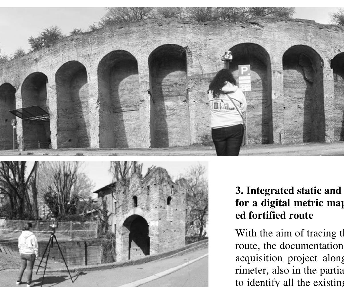
The analysis of the fortified routes in the city of Pavia (Italy) clarifies the adaptation of the medieval capital in the historical politics of the Mediterranean, where the evolution of the defensive system till the Spanish bastioned... more
Sayısal Yükseklik Modeli (SYM) yeryüzünün katı kısmını oluşturan kara parçalarının diğer bir ifade ile topoğrafyanın deniz seviyesinden yüksekliğini, coğrafik konumu ile birlikte nicelik olarak ifade etmek üzere geliştirilirmiş ve yaygın... more
Kapadokya bolgesinde bulunan peri bacalari ve kayalik alanlar, yagmur, ruzgâr, sicaklik ve diger fiziki etmenler nedeniyle surekli deformasyona maruz kalmaktadir. Bu deformasyonlar ve kayac yapilari nedeniyle bolgede cok fazla kaya... more
Öz İnsansız hava araçlarının (İHA) kullanımı, geliştirilen yazılım ve donanım bileşenleri ile günümüzdeki mühendislik uygulamalarında oldukça yaygınlaşmıştır. Farklı yükseklik ve hızlarda uçuş imkânı sağlayan İHA'ların, yüksek... more
Sayısal Yükseklik Modeli (SYM) yeryüzünün katı kısmını oluşturan kara parçalarının diğer bir ifade ile topoğrafyanın deniz seviyesinden yüksekliğini, coğrafik konumu ile birlikte nicelik olarak ifade etmek üzere geliştirilirmiş ve yaygın... more
Günümüzde boyutu hızla küçülen ve özellikleri artan kamera, batarya ve küresel konumlama sistemleri sayesinde insansız hava araçları (İHA) ve modern fotogrametrik metotları kullanan görsel işleme yazılımları hızla gelişmektedir. İHA... more
Terrestrial methods and photogrammetric method are generally used in the production of maps. In recent years, along with these two methods, the Mobile LIDAR (Light Detection and Ranging) technique has begun to be employed in the... more
Sayısal Yükseklik Modeli (SYM) yeryüzünün katı kısmını oluşturan kara parçalarının diğer bir ifade ile topoğrafyanın deniz seviyesinden yüksekliğini, coğrafik konumu ile birlikte nicelik olarak ifade etmek üzere geliştirilirmiş ve yaygın... more
Ekonomisi tarima ve turizme dayali olan Mersin Şehri’ nde pek cok arkeolojik sit alani ve dogal guzellikler bulunmaktadir. Akdeniz iklimi sehri yilin her mevsimi cazip duruma getirmistir. Tarih boyunca bolgede pek cok uygarlik yasamis ve... more
Heyelanlar can ve mal kaybina neden olan dogal afetlerdendir. Zemin ve kaya kutleleri uzerindeki kuvvetlerin degismesi sonucu olusan heyelanlar ulkemizde yaygin olarak gorulmektedir. Engebeli araziler heyelana karsi meyilli bolgelerdir.... more
This research develops an automatic algorithm for orange fruits sorting image processing technique in MATLAB (7.8) program. The orange fruits were acquired using a digital camera in illumination chamber. A picture handling system was... more
Günümüzde boyutu hızla küçülen ve özellikleri artan kamera, batarya ve küresel konumlama sistemleri sayesinde insansız hava araçları (İHA) ve modern fotogrametrik metotları kullanan görsel işleme yazılımları hızla gelişmektedir. İHA... more
Vegetation is the major cause of overhead power line failures. According to a recent HydroQuebec analysis, more than 60% of the power outages are related to vegetation. Specifically, when branches/trees nearby the distribution network... more
ZET Lazer tarayıcı ölçüleri tarayıcı alet merkezli yerel koordinatlardır. Bu ölçülerin fotogrametrik ve topoğrafik ölçülerle yada başka taramalarla birleştirilebilmesi için ölçülerin ortak bir koordinat sisteminde ifade edilmesi gerekir.... more
Son yıllarda, üç boyutlu (3B) yeryüzü konum bilgisi sağlayan uzaktan algılama teknolojilerinin kullanımı, özellikle yer yüzeyi ve bileşenlerini inceleyen meslek disiplinleri için vazgeçilmez hale gelmiştir. Bu meslek disiplinleri arasında... more
Türkiye, sahip olduğu jeomorfolojik yapısından dolayı sıklıkla can ve mal kaybına yol açan doğal afetlere maruz kalmaktadır. Son yıllarda afetlerle mücadele için hazırlanan mühendislik projelerinde fotogrametrik yöntemler sıklıkla... more
Jeodezik izleme ağlarında duyarlılık analizi genellikle, ilgili ağda beklenen yerdeğiştirmeleri öngörülmüş hata olasılıklarıyla saptamaya uygunsa, belirlenebilecek en küçük yerdeğiştirmelerin belirlenmesi veya ortaya çıkarılmasını sağlar.... more
Surface terrain information is required to economically site new or relocate existing infrastructure facilities & make final design plans. In today scenario field surveying & photogrammetric mapping are the most widely used method to... more
Roadside feature data are critical inputs to highway safety models as described in the Highway Safety Manual (HSM). Collecting safety-related roadside feature data is an important step for HSM implementation. Many states' department of... more
Heyelanların tespiti, izlenmesi, tehlikesi ve riskinin belirlenmesi, olası zararlarından korunulması ile afet durumunda atlatılması-yönetilmesi pek çok karmaşık işlem adımlarını barındırmaktadır. Bu işlem adımları genellikle heyelan... more
by Bilge Doran and 
1 more
Rölatif yer değiştirmeler, göreli kat ötelemelerinin değerlendirilmesinde ve yapılardaki hasar dağılımının belirlenebilmesinde oldukça önemli bir rol oynarlar. Uzun periyotlu yapılarda, yapısal izleme yardımıyla çatı yer değiştirmelerin... more
Bu makalede, tek rotorlu sabit kanatlı bir İnsansız Hava Aracı (İHA) için MATLAB / Simulink yazılımları kullanılarak tasarlanan gerçek zamanlı (Real Time Windows Target) oto-pilot ve X-Plane simülatörü kullanılarak gerçekleştirilen uçuş... more
Download research papers for free!