580 California St., Suite 400
San Francisco, CA, 94104

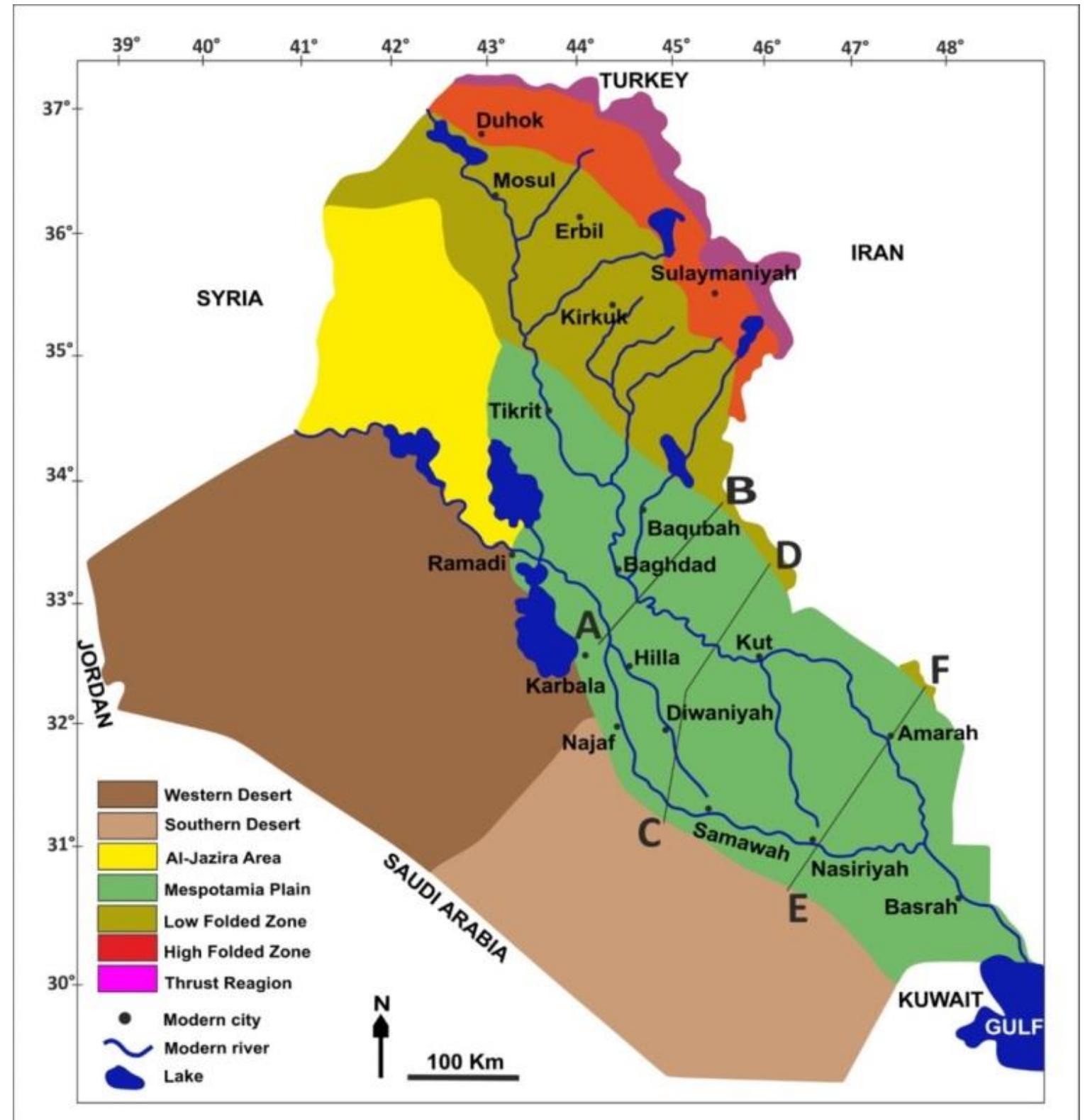
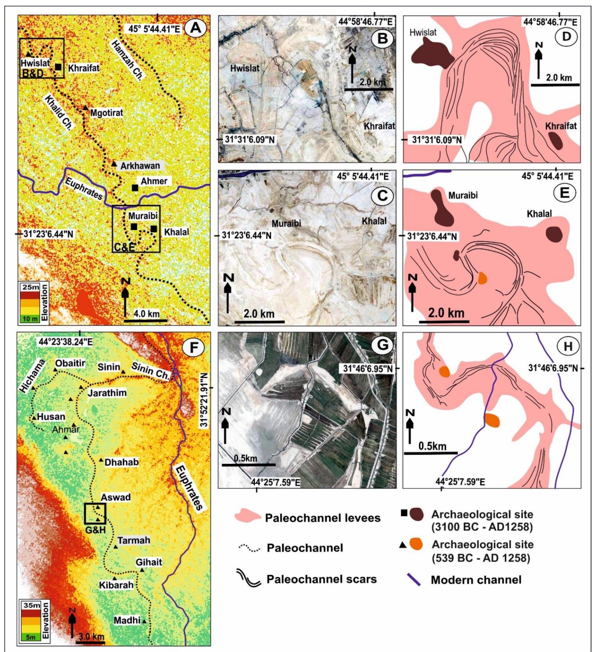
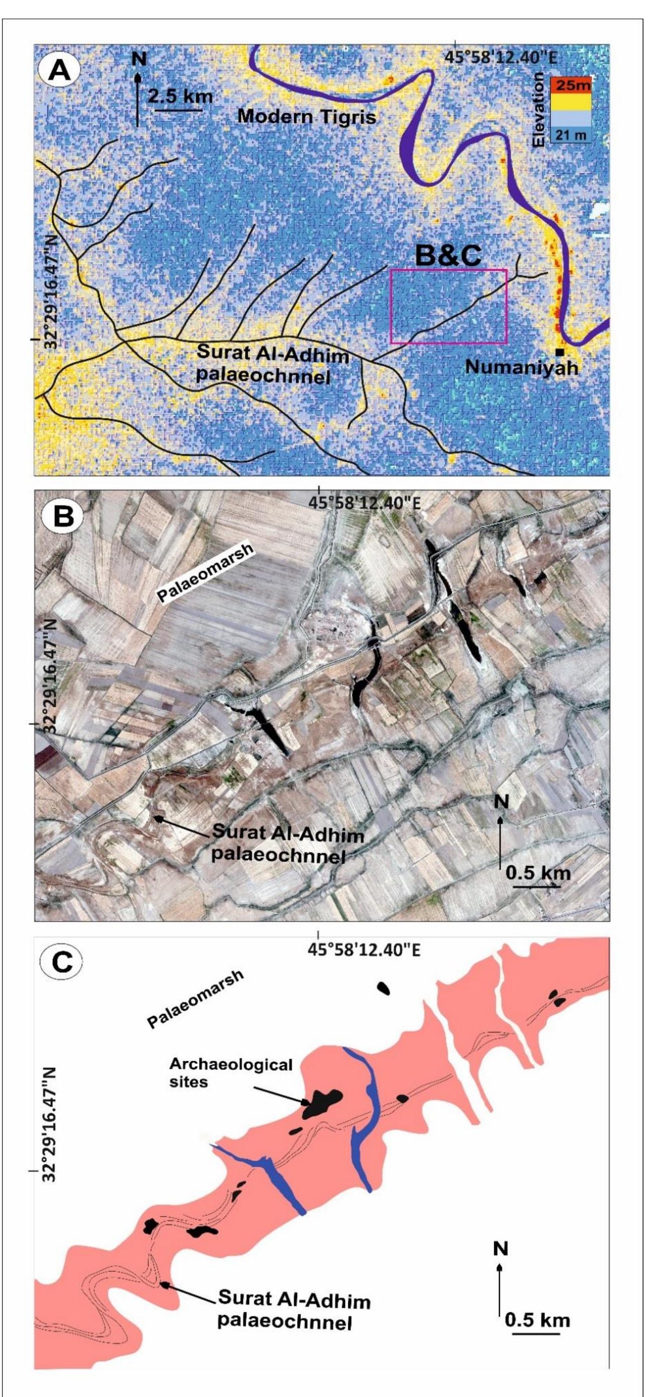
Figure 3 9: SRTM data (A) for the north part of the present study (see Figure 3.8 for location) showing how palaeochannel levees are elevated in relation to the surrounding floodplain. Main modern channels are indicated by solid lines; palaeochannels by dotted lines. QuickBird images (B-E) and interpretations of features on these images (F-l), respectively. The QuickBird images show selected examples of relict channel meander loops and a series of human settlements, which are evidence that the channel was present at the time of settlement.