580 California St., Suite 400
San Francisco, CA, 94104

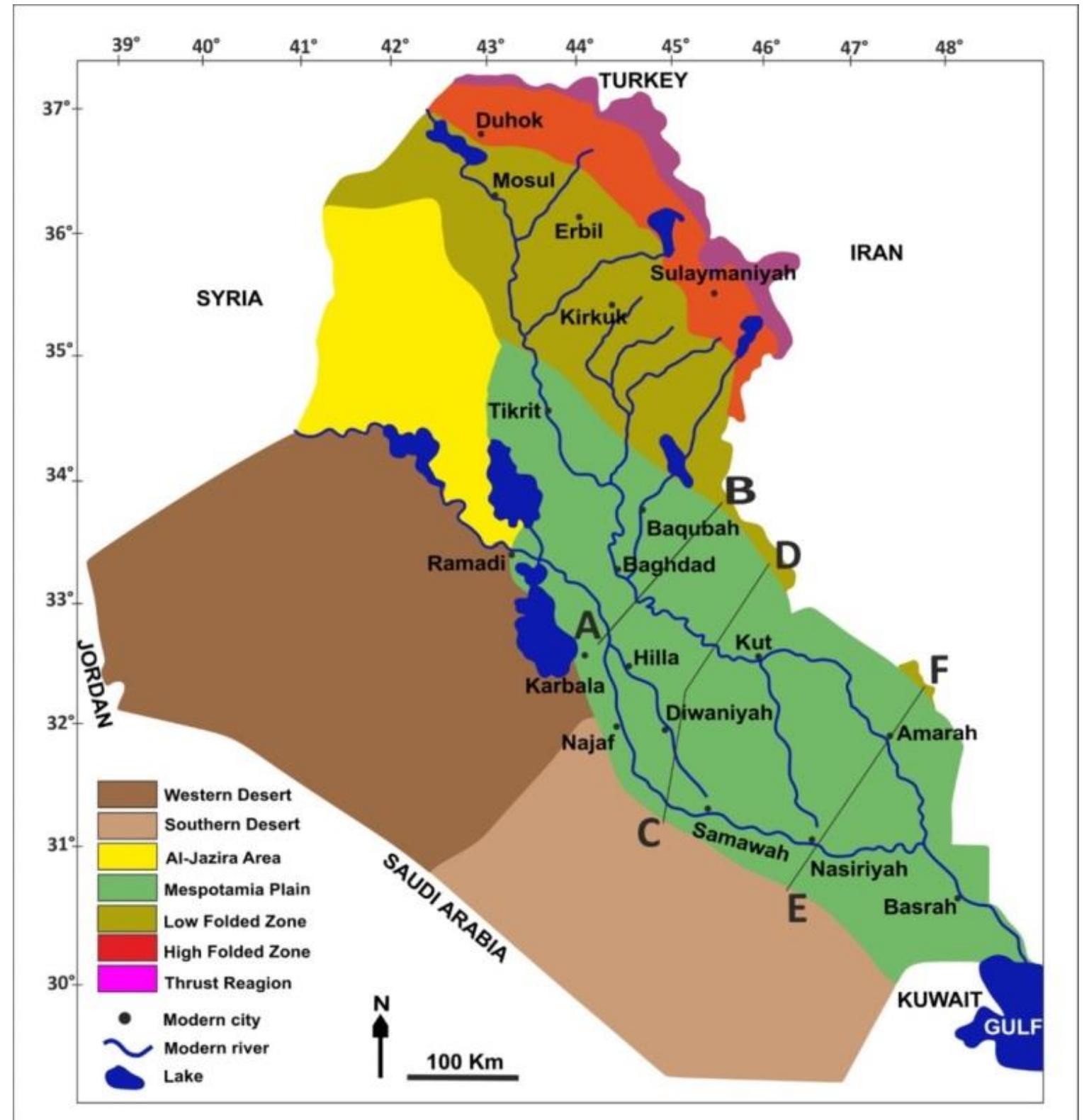
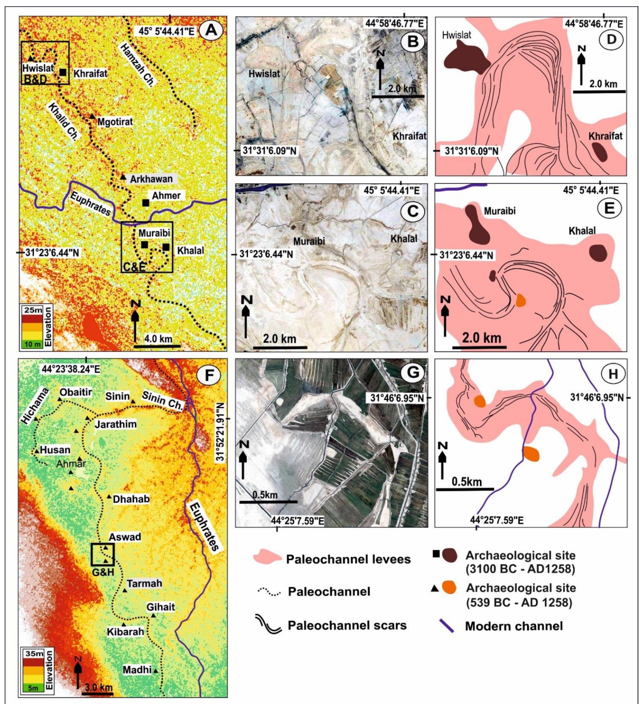
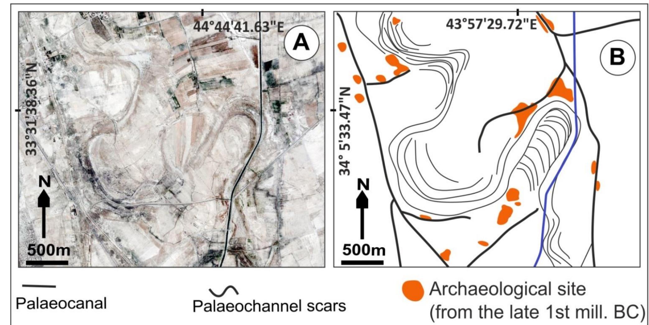
Figure 2 2: Example of elevated topography associated with a palaeochannel from an area to the south of Hilla, as i appears in SRTM data. anomalies, such as mounds and levees in other images. ‘one refers to the relative brightness i.e. strength of reflectance and colour of objects in al mage. Palaeochannel levees (Fig. 2.4) and the isolated islands of archaeological mounds (Fig .5 and Fig. 2.6) can be recognized in QuickBird images because of their differences in tone an olour. In QuickBird imagery, the essential element for distinguishing between different object yr features is the colour of the objects (Fig. 2.7A), whereas in CORONA, in the negative format, i s the brightness of the objects (Fig. 2.7B). In several cases it is difficult to recogniz yalaeochannels in QuickBird images (Fig.2.7A) because there is not enough relative brightness ‘Therefore CORONA images (Fig. 2.7B) proved better to trace the feature (Fig.2.7C and7D) Jowever, in some places, the advantage of cultivation of the land is evident, leading to change n the tone of the irrigated land and producing archaeological mounds, which become mor ecognisable as the farmer develops the area around the site, making it easy to see th inomalies, such as mounds and levees in other images.