580 California St., Suite 400
San Francisco, CA, 94104

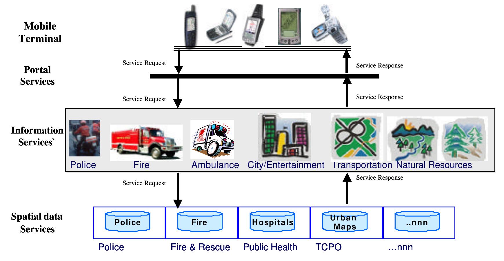
Figure 12 5.1 Three Players that are bind together with the Geographic Information the players with geographic information can be visualized as shown in figure: 5.1. In the context of location based emergency services there could possibly be three main players i.e. the user (who reports the incident), the mobile operator or the wireless network provider (helps in proper communication and routing the call to the nearest emergency centre) and the emergency organization (who are responding the emergency). These emergency services must be ubiquitous for the nomadic users as termed by Yu et al., 2003c. These three players are bind together by the geographic information at each step for the user and the emergency organization (chapter-4). Similarly, for the mobile operators the geographic information helps in required for deciding the location of the transmitting towers their coverage area and the cell sizes. Binding all the players with geographic information can be visualized as shown in figure: 5.1. Assuming that the geospatial data required by the emergency services for effective and speedy response are available and is provided by the geospatial repository i.e. Indian NSDI this can be seen by setting up the whole scenario in to client server architecture as shown in figure: 5.2. Considering the actual scenario where user at the time of emergency calls the emergency number (emergency number depends up on country to country), his call is then routed to the nearest emergency control centre by the mobile operator. But, once the call is routed to the nearest ECC they might want to have access to the maps with the position of the user or the incident on to it. response are available and is provided by the geospatial repository i.e. Indian NSDI this can be