580 California St., Suite 400
San Francisco, CA, 94104
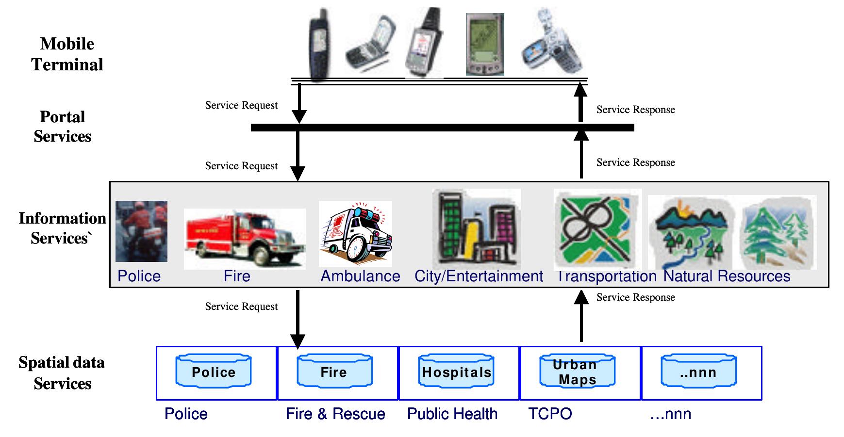
Figure 3 of information end user devices” (Toronen, 2003). On the first tier are the basic spatial data services, which are continuously updated by the value added service developers. Second tier utilizes the spatial data from the first tier to build the information services. “On this level different source of spatial data are possibly integrated, specific location dependent information is added, and the resulting information product is offered to the next layer in the architecture. In this process the location of the actual user, available from the applied mobile device technology, might also be made use of’. The third tier has two views it is easy to use directory services facilitating the discovery of location-based services and from the service providers vie w to adapt “the resulting service information appropriately for each category of information end user devices” (Toronen, 2003).