580 California St., Suite 400
San Francisco, CA, 94104

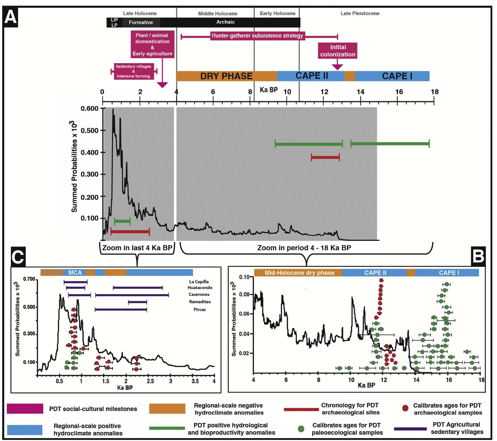
Figure 1 Study area showing (A) the extent of the Pampa del Tamarugal (PDT) within the Atacama Desert. The dashed line (X-X’) describes the topographic profile with major topographic and vegetation units (shown in B).