580 California St., Suite 400
San Francisco, CA, 94104
A considerable body of research within the GlobalSoilMap initiative and associated efforts focuses on rescuing, standardizing, and harmonizing historical, legacy soil data scattered in disparate analog and digital formats worldwide. This transformation of fragmented and heterogeneous legacy data into interoperable, quality-assessed, and georeferenced soil profile databases is foundational for creating continuous, spatially explicit soil property maps compliant with GlobalSoilMap specifications. The challenge is to convert diverse national and regional soil survey data, affected by variations in classification systems, analytical methods, and spatial referencing, into consistent, reliable inputs for digital soil mapping at global scales.
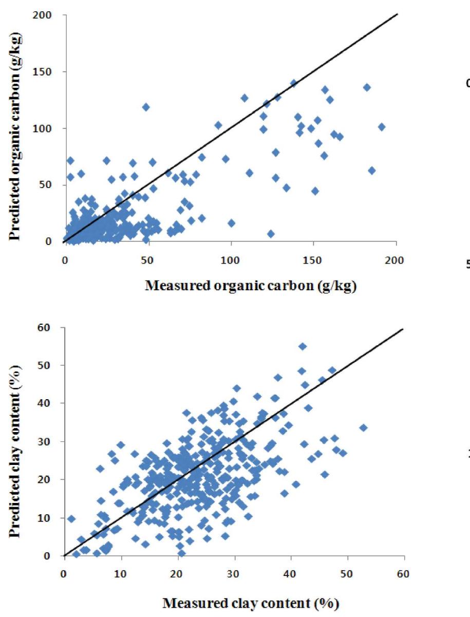
A major research thrust investigates the precision and applicability of existing global and regional soil property maps for site-specific management scenarios, particularly in agriculture. Given the coarse resolution, extrapolation errors, and methodological differences in soil data compilations, the actual utility of digital soil maps in informing field-scale decisions remains uncertain. Validation studies using ground truth soil observations assess how well prominent soil mapping products capture key soil attributes like texture or organic carbon, examining implications for agronomic recommendations and ecosystem modeling.
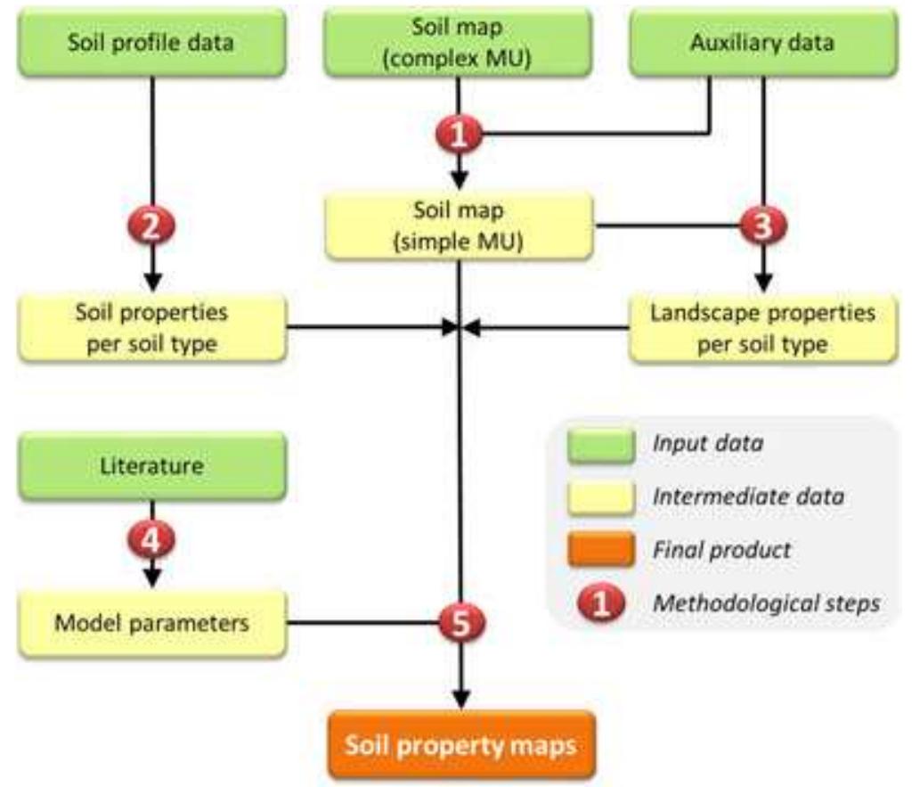
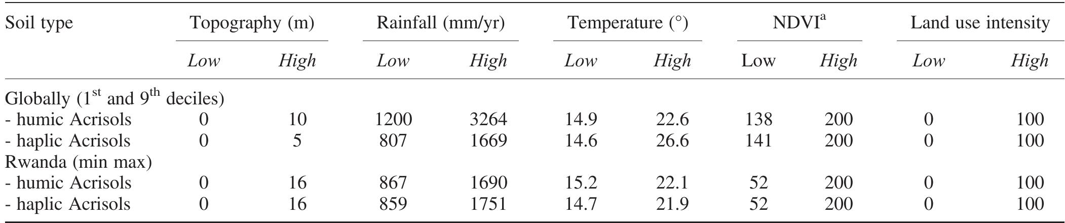
Digital soil mapping faces challenges in regions with sparse soil observations or complex terrains. Research has focused on methodological adaptations such as statistical and machine learning approaches, landscape-driven models, and extrapolation of calibrated models from well-sampled pilot areas to broader regions with similar physiographic characteristics or climate. These strategies aim to produce accurate, scalable soil maps suitable for ecological conservation, land-use planning, and environmental modeling where direct soil measurements are limited.