Academia.eduAcademia.edu

ELECTRICAL RESISTIVITY TOMOGRAPHY

description3,981 papers
group424 followers
lightbulbAbout this topic
Electrical resistivity tomography (ERT) is a geophysical imaging technique that measures the subsurface resistivity distribution by injecting electrical currents into the ground and recording the resulting voltage differences. This method is used to infer geological structures and properties, aiding in environmental, engineering, and hydrogeological investigations.

Key research themes

1. How can image reconstruction and error management techniques improve the resolution and reliability of Electrical Resistivity Tomography (ERT)?

This research theme focuses on advancing computational and mathematical methods that enhance the quality, accuracy, and robustness of Electrical Resistivity Tomography images. Due to the ill-posed and nonlinear nature of the ERT inverse problem, improvements in error quantification, regularization, adaptive meshing, and sensitivity analysis are critical to reducing artefacts and producing reliable subsurface images for various applications.

Key finding: Developed a novel methodology to quantify time-lapse ERT data errors by analyzing discrepancies between normal and reciprocal measurements at different times; demonstrated that incorporating these specifically estimated... Read more
Key finding: Conducted a quantitative comparison of image appraisal metrics such as model resolution matrix (R), cumulative sensitivity matrix (S), and depth of investigation index (DOI); identified that R and S matrices provide the most... Read more
Key finding: Introduced a staggered grid inversion scheme that performs repeated inversions on offset grids and averages results to reduce artefacts and minimize inversion ambiguities; demonstrated superior reconstruction robustness and... Read more
Key finding: Proposed an object-oriented sensitivity matrix estimation (OO-SME) model that estimates the change in sensitivity matrices accounting for object-field conductivity variations, significantly reducing approximation errors in... Read more

2. What are the optimal measurement strategies and electrode configurations to maximize information content and image quality in Electrical Resistivity Tomography?

This theme addresses the design and selection of current injection patterns and potential measurement strategies to improve the distinguishability and stability of ERT data. By evaluating electrode arrays, current injection schemes, and measurement modalities through theoretical, control-theoretic, and empirical analyses, researchers aim to identify the most informative configurations that reduce artefacts and enhance spatial resolution, especially in complex geometries.

Key finding: Performed a control-theoretic and matrix-based analysis of various pair-wise current injection patterns and potential measurement types; demonstrated that single-ended potential measurements generally provide higher... Read more
Key finding: Proposed and numerically validated ‘L’ and ‘Corner’ electrode array configurations designed to circumvent the limitations of conventional grid-based ERT surveys in urban and obstructed environments; showed these arrays... Read more
Key finding: Analyzed and proposed optimized electrode measurement subsets and inversion approaches for single borehole-to-surface ERT to overcome symmetric artefacts inherent in standard smoothness constrained inversion; results from... Read more
Key finding: Reviewed and compared four ERT electrode array data collection strategies—Adjacent, Opposite, Diagonal, and Conducting Boundary—with respect to their measurement and image reconstruction efficiency; identified trade-offs in... Read more

3. How is Electrical Resistivity Tomography applied across diverse fields to reveal subsurface structures, and what are the methodological adaptations specific to those applications?

This theme explores the deployment of ERT in varied scientific and engineering disciplines including archaeology, hydrogeology, cultural heritage protection, and process engineering. It focuses on how methodological adaptations—such as array configurations, inversion schemes, and integration with complementary techniques—enable effective mapping and monitoring of subsurface features under domain-specific constraints and objectives.

Key finding: Applied Wenner-Schlumberger array ERT with 1 m electrode spacing in an archaeological necropolis, producing 3D volumetric resistivity models after finite-difference inversion of parallel profiles; successfully identified high... Read more
by Suzanna Aw and 
1 more
Key finding: Reviewed the evolution and challenges of applying ERT in industrial process monitoring involving conducting vessel walls; highlighted innovations like FPGA-based programmable systems to handle multiphase flows and complex... Read more
Key finding: Utilized 2D ERT combined with Induced Polarization measurements to delineate groundwater zones at a paddy cultivation area facing dry season water scarcity; resistivity models inverted using RES2DINV software identified... Read more
Key finding: Introduced a novel borehole-to-surface-to-cliff (BSC-ERT) measurement scheme tailored for imaging complex grotto rock structures on steep cliffs; numerical simulations showed that a combined AM-BN electrode array... Read more

All papers in ELECTRICAL RESISTIVITY TOMOGRAPHY

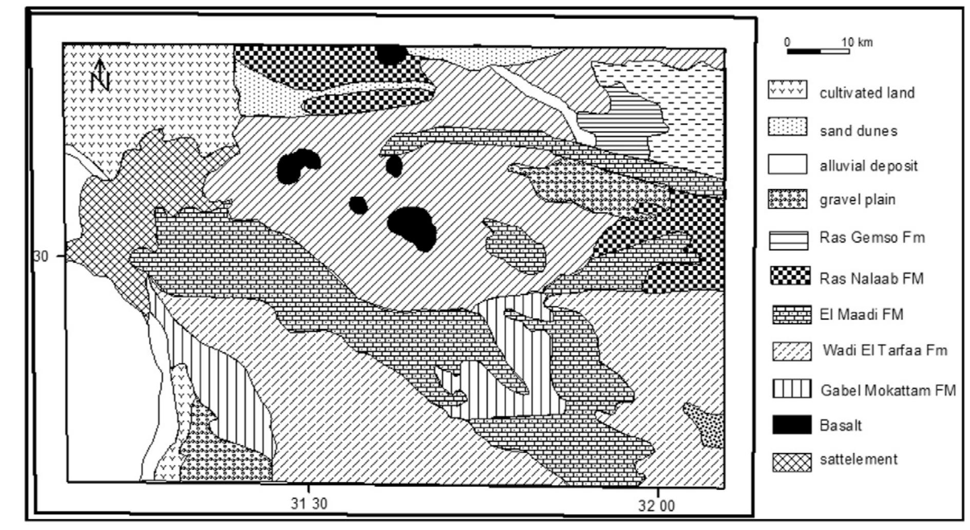
In this study, an integrated suite of geological and direct current resistivity (DCR) data is used to evaluate the hydrogeophysical conditions at the downstream part of Wadi Ramleiya, Eastern Desert, Egypt. Geological and morphometric... more
Cross-borehole geoelectrical imaging, in particular electrical resistivity tomography (ERT) and transmission radar tomography, can provide high-resolution images of hydrogeological structures and, in some cases, detailed assessment of... more
The flood plain of the Nile River has been a safe dwelling throughout history. Recently with a growing population and vast growing urbanization some buildings have started to experience structural damages, which are not related to their... more
Electrical resistivity tomography was used in order to explore an experimental site of the LaSalle Beauvais Polytechnic Institute (France). The test was conducted along a profile line of 315 m length, using 64 electrodes deployed at an... more
Asgeir Kydland Lysdahl, Sara Bazin, Craig Christensen, Sven Ahrens, Thomas Günther, Andreas A. Pfaffhuber
Resistivity method is developed rapidly during the 25 years ago. The most important method is 2D and 3D resistivity imaging, which is used for engineering, environmental, mining, etc. however, the vital feature that use to interpret 2D... more
The detection and mapping of unmarked graves is a significant focus of many archaeological and forensic investigations however traditional methods such as probing, forensic botany, cadaver dogs or dowsing are often ineffective, slow to... more
The flood plain of the Nile River has been a safe dwelling throughout history. Recently with a growing population and vast growing urbanization some buildings have started to experience structural damages, which are not related to their... more
A segment of the Upper Rhine River presenting both anastomosed and braided was investigated. This area gives us the opportunity to study settlement dynamics during two key periods of the Holocene. The Roman Period characterised by a first... more
Ur, the city of the moon god and “Home of Abraham” was founded by settlers in the 4th millennium BC. The remains of the site are located 345km south of Baghdad and 257km away from the Persian Gulf. It is one of the most prominent cities... more
Geophysical surveys for cavity detection are one of the most common nearsurface applications. The usage of resistivity methods is also very straightforward for the air-filled underground voids, which should have theoretically infinite... more
Set of parallel oriented ERT profiles was used for identification of fluvial channels in the area near the Western Gate of the Great Moravia Empire agglomeration Pohansko near Břeclav. Three infills of fluvial channels were identified... more
— In the last two decades the village of Casalabate was affected by a number of sinkhole events, the last episode occurring on 7 January 2012. Due to some geological and geotechnical uncertainties, Casalabate became an intriguing case... more
The Causse of El Hajeb belongs to the Tabular Middle Atlas (TMA), in which thousands of karst landforms have been identified. Among them, collapse dolines and dissolution sinkholes have been highlighted as a source of environmental risks... more
The presence of natural voids and cavities in subsurface karstic limestones causes severe problem for civil engineering and environmental management. The presence of such features hinders the extension of urbanizations particularly in the... more
Collapse dolines are closed karst depressions of various size and morphology, which can be found all over the Slovenian karst. A collapse of cave chamber roofs is the basic mechanism of their formation. Limited dimensions of cave chambers... more
Prospections géophysiques multi-méthodes de structures portuaires antiques à Narbonne (Aude, France) Multi-method geophysical surveys of ancient port structures of Narbonne (Aude, France
Information about the internal structure of rock glaciers is needed to understand their reaction to ongoing climate warming. Three different geophysical techniques-shallow seismic refraction, ground-penetrating radar (GPR) and electrical... more
This work aims to investigate the applicability of electrical resistivity tomography (ERT) as a non-destructive tool of agricultural soil characterization after digestate of fruit and vegetable (DFV) amendment application. DFV was applied... more
The presence of natural voids and cavities in subsurface karstic limestones causes severe problem for civil engineering and environmental management. The presence of such features hinders the extension of urbanizations particularly in the... more
Recent changes in the fluvial dynamics of the middle Garonne river (SW France) are approached by combining historical maps and data field (cores and Electrical Resistivity Tomographies – ERT). This study is carried out at the scale of a 5... more
A study of cerebral hemorrhage detection using computed tomography with head image has been done. The process after detection is the determination of the area and volume of hemorrhage. Image processing techniques used are Segmentation of... more
The study of electrical resistivity anisotropy in rocks has become important in increasing the accuracy of geological mapping using electrical resistivity survey. The study area, Iwaro-Ayepe in Akoko, southwestern Nigeria, has been... more
The phenomenon of building collapse in recent times has become a source of national concern. Particularly alarming is the situation in Lagos, the commercial nerve center of Nigeria. Several attempts made to... more
Natural processes are known to cause significant damage to archaeological monuments. In fact, the key to understanding the decay of building materials is the internal movement of water through the mineral matrix, which influences the... more
Rapid growth of residential colonies around the campus of the CSIR-National Geophysical research Institute (NGRI), Hyderabad during the last two decades has resulted in either disappearance or drastic reduction in size of open space and... more
This paper deals with the resistivity continuous surveys on extensive area carried out at the Mont'e Prama archaeological site, in Sardinia (Italy). From 2013 to 2015, new research was performed using both non-destructive surveys and... more
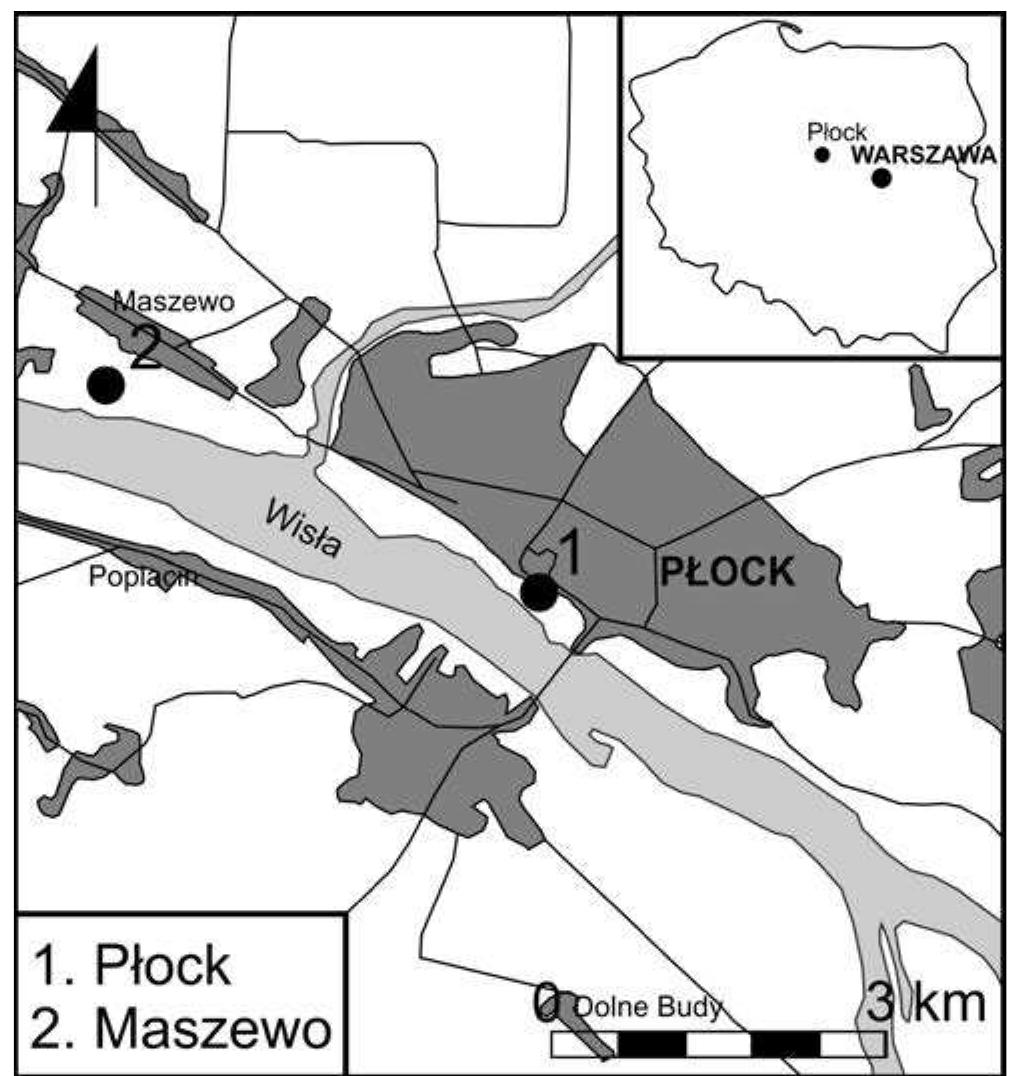
The article shows the results of geophysical surveys performed by using Electrical Resistivity Tomography (ERT) method on selected region of Płock slope of a Tumski hill near Basilica of Assumption of the Blessed Virgin Mary in Płock and... more
A geophysical study by means of electrical resistivity and induced polarization tomographies was carried out in the landfill site of Bellolampo (Palermo, Italy) to check the integrity of the landfill liner and to detect possible leachate... more
Tidal dynamics and especially storm surges can have an extensive impact on coastal fresh groundwater resources. Combined with the prospect of sea-level rise and the reliance of many people on these resources, this demonstrates the need to... more
Electrical resistivity tomography was used in order to explore an experimental site of the LaSalle Beauvais Polytechnic Institute (France). The test was conducted along a profile line of 315 m length, using 64 electrodes deployed at an... more
A large-scale electrical resistivity tomography (ERT) survey was undertaken around the Neolithic tell of Szeghalom-Kovácshalom in southeast Hungary, covering an area of almost 6 ha. High-resolution ERT data were collected along 28... more
A validation experiment, carried out in a scaled field setting, was attempted for the long electrode electrical resistivity tomography method in order to demonstrate the performance of the technique in imaging a simple buried target. The... more
Occurrences of surficial karstic depressions in south-central Georgia are generally attributed to the dissolution within the Floridan aquifer even though it is overlain by a confining unit of varying thickness. This study explores the... more
Investigating sinkhole morphology and formation mechanisms is key to understanding their long term impact and susceptibility to development, and aids in the design of effective mitigation measures. In this study, ERT (electrical... more
by Thomas Hermans and 
1 more
Electrical resistivity tomography is a well-known technique to monitor fresh-salt water transitions. In such environments, boreholes are often used to validate geophysical results but rarely used to constrain the geoelectrical inversion.... more
This article is an open access article distributed under the terms and conditions of the Creative Commons Attribution (CC BY)
This paper deals with the resistivity continuous surveys on extensive area carried out at the Mont’e Prama archaeological site, in Sardinia (Italy). From 2013 to 2015, new research was performed using both non-destructive surveys and... more
of electrical resistivity tomography. Surveys were conducted over 3 grave types at 3 different sites.
Rapid growth of residential colonies around the campus of the CSIR-National Geophysical research Institute (NGRI), Hyderabad during the last two decades has resulted in either disappearance or drastic reduction in size of open space and... more
1] With time-lapse electrical resistivity tomography (ERT), transport processes in the subsurface can be imaged and monitored. The information content of obtained spatiotemporal data sets opens new ways to characterize subsurface spatial... more
Carbon nanotubes (CNTs) treated by using a mixed solution of H 2 SO 4 and HNO 3 were uniformly dispersed into cement paste by means of ultrasonic energy. Electrical resistivity and pressure-sensitive properties under cyclic compressive... more
A quasi 3D electrical resistivity (ERT) survey was undertaken at a UNESCO World Heritage site, Saqqara, Giza, Egypt, during a joint archaeological-geophysical mission from Cairo University. The main objective is to detect the locations of... more
Download research papers for free!