Academia.eduAcademia.edu

Depositional Environments

description127 papers
group45 followers
lightbulbAbout this topic
Depositional environments refer to the specific settings where sediment accumulation occurs, influenced by factors such as energy levels, sediment supply, and biological activity. These environments are critical for understanding sedimentary processes, stratigraphy, and the geological history of an area.

Key research themes

1. How do sedimentary facies and architectural elements characterize depositional environments in clastic and mixed sedimentary systems?

This research area focuses on detailed sedimentological analysis of facies types and their architectural arrangements to reconstruct depositional settings. Providing insight into depositional processes, energy conditions, and paleogeography, these studies enhance prediction of reservoir quality in sedimentary basins. It matters for both academic understanding of sediment dynamics and practical applications such as hydrocarbon exploration.

Key finding: This study identified nine lithofacies grouped into seven architectural elements that collectively indicate a transitional fluvio-deltaic depositional environment for the Pab Formation. Detailed sedimentary structures (e.g.,... Read more
Key finding: Through lithofacies analysis including nine distinct facies and granulometric statistical parameters such as graphic skewness and standard deviation, the Fort Member sandstones were interpreted to be deposited in high-energy... Read more
Key finding: Using spontaneous potential well-logs analyzed through modified electro-facies classification and measured stacking patterns, four depositional facies were identified (foreshore regressive shoreface, transgressive shoreface,... Read more

2. What roles do microfacies and micropaleontological assemblages play in elucidating carbonate depositional environments across geological formations?

This theme investigates carbonate facies and their fossil content to interpret depositional environments, stratigraphic subdivisions, and paleoenvironmental conditions. Microfacies and microfossils provide precise paleoecological proxies capturing environmental gradients, bathymetry, and biological communities, vital for reconstructing carbonate platform dynamics and transitions during geological periods, which advances paleoenvironmental models.

Key finding: Analysis of 16 identified microfacies in the Mishrif Formation, including benthonic foraminiferal lime-wackestone and fossiliferous lime-packstones, allowed reconstruction of depositional sub-environments across a carbonate... Read more
Key finding: Microfacies and micropaleontological analysis of Upper Jurassic-Lower Cretaceous limestones revealed subdivisions into subunits differentiated by algal structures, miliolids, and microbial components, indicating a succession... Read more
Key finding: Field and microfacies analyses elucidated microbialite development and Microbially Induced Sedimentary Structures (MISS) during Early Triassic depositional evolution from dolosiliciclastic peritidal systems to bioclastic... Read more

3. How can geochemical parameters and remote sensing techniques be applied to distinguish and monitor depositional paleoenvironments and fluvial geomorphic changes?

This area focuses on quantitative analyses using geochemical proxies, chemometric tools, and remote sensing indices to characterize depositional settings and monitor dynamic fluvial processes. Integration of organic geochemical parameters and trace element distributions helps reconstruct paleoenvironments, while satellite-based water indices enable spatiotemporal monitoring of river morphology and erosion-accretion patterns. Such methods provide actionable insights for basin analysis and environmental management.

Key finding: By applying chemometric techniques such as Principal Component Analysis (PCA) and Hierarchical Cluster Analysis (HCA) to organic and inorganic geochemical proxies (including TOC, kerogen types, and rare earth element... Read more
Key finding: Using multi-temporal Landsat imagery combined with Normalized Difference Water Index (NDWI) and Modified NDWI (MNDWI), this study quantitatively mapped erosion and accretion dynamics over 48 years in Bangladesh's Padma-Meghna... Read more
Key finding: Through OSL dating, sedimentological analysis, and grain-size modeling of aeolian fines trapped beneath stone pavements, this study reconstructed episodic aeolian deposition phases linked to regional climatic shifts in the... Read more

All papers in Depositional Environments

This study intends to investigate the fluvial-geomorphic change and erosion-accretion processes of two significant rivers. The 2149 km2 research area's overall erosion and accretion were depicted using multi-temporal Landsat images and... more
This work provides a comprehensive overview of the potential of energy resources of African countries on the basis of the geological structure of sedimentary basins of the region. The countries have been categorized by the amount of... more
The reservoir characterization of the Yolde Formation was conducted to assess the hydrocarbon potential of the Kolmani field in the Gongola Basin, Upper Benue Trough. This evaluation utilized Pressure, Temperature, PVT, mobility, and well... more
This paper presents examples of ground-penetrating radar (GPR) data from two study sites in southeastern Florida where karstic Pleistocene platform carbonates that comprise the unconfined Biscayne aquifer were imaged. Important features... more
Limestone as a sedimentary rock is composed predominantly of carbonates of calcium (CaCO3) known as calcite. The primary source of the calcite in limestone is commonly shelly marine organisms which settle out of the water and are... more
Thirty (30) outcrop samples from a section at Gamawa area, Gongola basin, Northern Benue trough were palynologically analyzed to determine age, and paleo-depositional conditions of the strata. Lithological the section is composed of... more
REZIME U ovoj studiji je predstavljena procjena ekološkog stanja crnogorskog primorja na osnovu prisustva mikroplastike u barbunu (Mullus barbatus), osliću (Merluccius merluccius), dagnjama (Mitilus galloprovincialis) i u površinskim... more
The depositional environments and bivalve assemblages are determined for the Upper Cretaceous Hinoshima Formation of the Himenoura Group, Kamishima, Amakusa Islands, Kyushu, Japan. The Hinoshima Formation is characterized by a thick... more
Sažetak "Burano" facijes rasprostire se na širem području Jadranskog bazena (Hrvatska i Italija), a sastavljen je od gornjotrijaskih sedimenata, karničko-noričkog evaporitnog člana i retskog dolomitnog člana. S obzirom na puno veći broj... more
Serviço Geológico do Brasil -CPRM RESUMO: O presente trabalho revela a descoberta de paleotoca escavada por vertebrados de idade pleistocênica no entorno da vila de Vista Alegre do Abunã, Rondônia, Brasil. Representa um complexo sistema... more
This study presents an assessment of the phosphate resource in the eastern Dahomey basin using 3D lithoconstrained gravity inversion. The inversion results identified notable density anomalies within the Oshosun formation, primarily in... more
This field report presents a detailed stratigraphic and lithological study of the Salt Range, focusing on key sections such as Khewra Gorge and Zaluch Nala. The report covers both the Precambrian and Cambrian sequences, including major... more
This study focuses on depositional signatures within a Pleistocene oolite on north Andros Island, Bahamas. Andros Island, approximately 225km by 81km, is the largest island in the Bahamas and is located on the eastern margin of Great... more
condiciones anteriores sugieren un aporte más probable de estratos expuestos en la Cordillera Oriental, y el transporte como las condiciones climáticas tropicales solo permitieron preservar los detritos más estables, como el cuarzo.
Considering great demands for the energy as inside also outside Kosovo, it is very necessary to open the mine of Sibovc for coal exploitation, for existing thermo-plants, as well as for those which will be built in future in order to have... more
The study area lies within latitude N 07 to N 07 and longitude E 006’20” to E 006’45” on Ankpa Topographic Map Sheet 248NW. Biostratigraphic investigation was carried out by subjecting outcrop samples to palynological studies with view of... more
condiciones anteriores sugieren un aporte más probable de estratos expuestos en la Cordillera Oriental, y el transporte como las condiciones climáticas tropicales solo permitieron preservar los detritos más estables, como el cuarzo.
This study intends to investigate the fluvial-geomorphic change and erosion-accretion processes of two significant rivers. The 2149 km2 research area's overall erosion and accretion were depicted using multi-temporal Landsat images and... more
Este estudo teve como objetivo identificar e caracterizar as formas e os processos fluviais dominantes associados ao padrão de canal meandrante no vale aluvial do baixo curso do rio do Peixe, estado de São Paulo. As interpretações... more
RESUMO: Relativo à tectônica dos eventos precursores da gênese do Oceano Atlântico central, na Província Parnaíba ocorre a Formação Mosquito, uma sucessão de derrames basálticos com intercalações de camadas sedimentares. Estes depósitos... more
The present research has been discussed on the sediment textural characteristics of the coastal beach. Sediment plays a role of document landform formation. Various statistical parameters such as Graphical Mean Grain Size (Mz), Standard... more
The identification of an abrupt facies change between the Monserrate and San Francisco formations allows us to identify a Facies Dislocation on top of the Cretaceous marine sequence of the Neiva sub-basin, due to the uplift of the Central... more
Este trabalho apresenta resultados complementares aos apresentados por Bertolini, Costa e Lima (2016) sobre a morfoscopia das areias no vale do rio Uruguai, no oeste de Santa Catarina. Trata-se da análise morfoscópica das frações areia... more
Se informa sobre nuevos registros de localidades (cuadrículas UTM de 10 x 10 km) de mariposas diurnas en el macizo Cazorla-Segura (Jaén, España). Se incluye un listado de las especies de Rhopalocera confirmadas hasta el momento en dicha... more
Zbog specifične geomorfologije, složene geološke građe, te uslijed nagle i često neodgovarajuće izgradnje građevina, na području podsljemenske zone grada Zagreba prisutan je problem vezan uz stabilnost padina. Brojna klizišta... more
Nguyen V. Kyl, Do T. Huni I Ho Chi Minh City University of Technology 2Solilhern Division of Hydrogeology and Engineering Geology During the history of plain evolution, geographical landscape had been continuously changed, periods of... more
3D numeričkim modelom provedena je numerička analiza dinamike pronosa slane vode u koritu rijeke Neretve na dionici 0+000.0 m - 25+000.0 m. Osim postojećeg stanja korita rijeke analizirane su i hipotetske situacije sa izvedbom jedne brane... more
Infralittoral and circalittoral hard bottom communities in the northern part of the Velebit Channel were investigated. The benthos was collected along six transects: three on Prvi} Island ([ilo, Samonjin and Stra`ica) and three facing... more
Sediments from the Kolmani River-1 well in the Gongola Basin, Northern Benue Trough, Nigeria, have been analyzed for palynomorphs from 900 ft to 9140ft. The main lithologies encountered in the well consist of sandstones, sandy shales,... more
Tides, both today and in ancient times left distinguishing characteristics that are recognizable. Some of these also help us to measure how long it took for them to be deposited. The time periods demonstrated just don't fit the flood... more
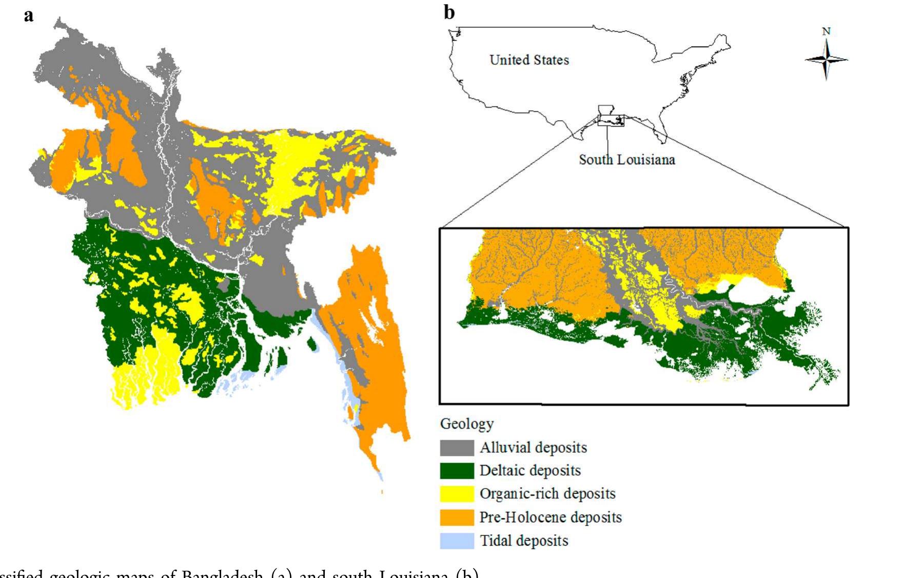
Groundwater contaminated with arsenic (As) threatens the health of more than 140 million people worldwide. Previous studies indicate that geology and sedimentary depositional environments are important factors controlling groundwater As... more
Este Pequeno Guia de Estruturas Sedimentares foi desenvolvido usando como modelo os guias de campo publicados pelo Field Museum Field Guides . Também as publicações de Nowatzki, 2019 , Nowatzki et alli, 1982 , Nowatzki et alli, 1983 ,... more
This study intends to investigate the fluvial-geomorphic change and erosion-accretion processes of two significant rivers. The 2149 km2 research area's overall erosion and accretion were depicted using multi-temporal Landsat images and... more
En la cordillera oriental de Colombia y el oeste del bloque Maracaibo, las unidades arenosas del paleoceno presentan diferencias composicionales significativas, sugiriendo cambios de régimen tectónico en las áreas de aporte o en las... more
Iz,`adak: ()vaj rad razmatra obalno podrue i podmorje Rx'jekog zaljeva. Recentni reljef u podruju Rijekog zaljeva posljedica je tektonskih pokreta, promjena klime i morske razine tijekom be geolokc proosti, a takoder i egzogenetskih... more
En la cordillera oriental de Colombia y el oeste del bloque Maracaibo, las unidades arenosas del paleoceno presentan diferencias composicionales significativas, sugiriendo cambios de régimen tectónico en las áreas de aporte o en las... more
sediment from Arasalar river mouth (ARM North and ARM South) in Karaikal region of Pondicherry Union territory and Southern part of Tamil Nadu have been carried to using the textural parameters. The samples were processed and sieved... more
Khor Eit area is exposed geological units located at about 70 km north of Port-Sudan town along the Red Sea coast of Sudan, it may implement very important role for understanding the rifting process. The overall objective of this study is... more
This report describes the geothermal resources and potential in Hanoi basin followed by the results of heat flow and subsurface temperature studies. The not small size 40 km × 14 km of high heat flow anomaly with values more than 100 mW/m... more
Agradeço a Deus pela minha vida, e por ter permitido que esse trabalho acontecesse. À minha mãe pela compreensão, apoio, suporte emocional e incentivo nas minhas decisões e ao longo de todo meu percurso na faculdade como profissional e... more
TEMELJNA DOKUMENTACIJSKA KARTICA Sveučilište u Zagrebu Prirodoslovno-matematički fakultet Geološki odsjek Diplomski rad MARINSKE MIOCENSKE NASLAGE NA LOKALITETU DUBRAVICA OKRETIŠTE (JUGOZAPADNA MEDVEDNICA) MARTA GJIRLIĆ Rad je izrađen u... more
Ao prof. Dr. Joel Pellerin pelo aprendizado proporcionado durante a orientação deste trabalho. Ao prof. Dr. Marcelo A. T. de Oliveira, pela disponibilidade em participar como coorientador. Ao CNPq pela concessão de bolsa para realização... more
O Gráben Moirão localiza-se próximo às localidades de Canguçu, Amaral Ferrador,Encruzilhada do Sul e Santana da Boa Vista. Possui 25 km de largura (eixo NW) e 45 km de comprimento (eixo NE), sendo limitado por falhas de orientação... more
Na regiao de Manaus afloram as unidades sedimentares Novo Remanso (Mioceno Medio) e Alter do Chao (Cretaceo / Paleoceno – Mioceno). Nesta ultima ocorrem corpos silicificados, atualmente denominados de Arenito Manaus. Os poucos trabalhos... more
Download research papers for free!