Figure 33 – uploaded by Ahmed Zaki

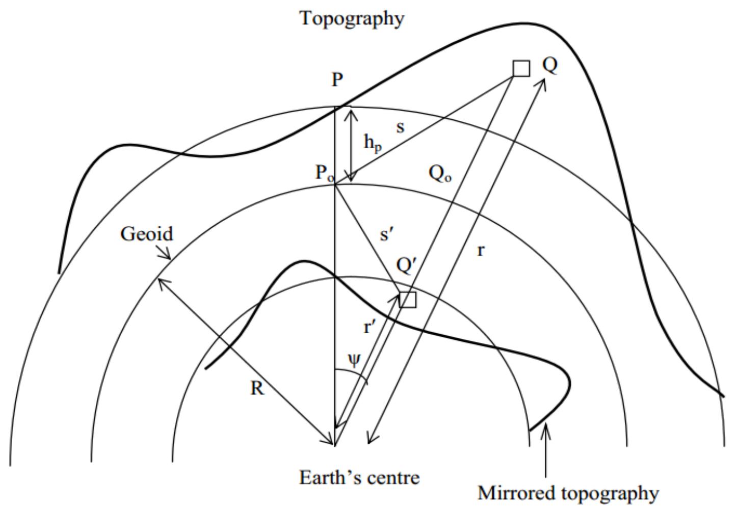
Figure 33 To compute RTM omission error estimates, we construct the RTM as difference between the 30 arc second Shuttle Radar Topography Mission (SRTM) elevation model and the spherical harmonic expansion of the DTM2006.0 elevation data base (Pavlis et al. 2007), expanded to degree 2,160. Subtraction of DTM2006.0 spherical harmonic elevations from the SRTM elevations removes a large part of the “spectral information’ already implied by EGM2008 (expanded to degree 2,190). The SRTM—DTM2006.0 residual topography possesses spectral energy beyond the resolution of EGM2008 (in spectral band nz +1=2,191 to~21,600, which is equivalent to the SRTM resolution of 30 arc second).The computation scheme for applied SEM in evaluation of GGM with GPS/levelling stations, the geoid model for Egypt EGGMO08 and ground gravity anomalies points will discuss in the next sections.
Related Figures (94)


Connect with 287M+ leading minds in your field
Discover breakthrough research and expand your academic network
Join for free