580 California St., Suite 400
San Francisco, CA, 94104

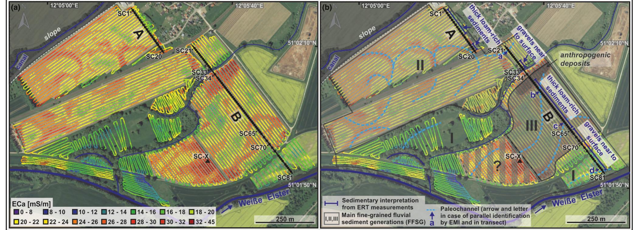
Figure 11 Fluvial architecture of the three studied transects according to Houben (2007) with relative chronologica units and water levels during HQ100 and HQ200 floods: (a) Salsitz, (b) Trebnitz, (c) Meilitz. Notes: (i) The radiocarbon ages in Salsitz were taken from Ballasus et al. (2022). Unlike in that publication, after a careful re-evaluation of the original stratigraphical-sedimentological data we did not classify levee deposits in this transect. (ii) In many cases we could not safely discriminate the different BD/CH gravel generations at the bases of the floodplain deposits outside the areas with the oldest paleosols in the overlying FF sediments. Therefore, only in cases were we have evidence for concomitant aggradation (carbonate in the fine-grained matrices of most gravels of part C of Trebnitz, brick fragments in the gravels of part A in Meilitz) we classified the underlying basal gravels into the same generation as the overlying FF sediments. (iii) Sources of f ooding levels in Salsitz and Trebnitz: Landesbetrieb fiir Hochwasserschutz und Wasserwirtschaft Sachsen-Anhalt (https://Ihw.sachsen-anhalt.de/service/ hochwasserkarten). For Meilitz we could not show the flooding levels: Due to artificial damming, flood extension during th of the transect is not shown on the maps of the Thtiringer Landesamt fiir Umwelt, Bergbau und Naturschutz (cf. Figure 16 ese events in the area c)