580 California St., Suite 400
San Francisco, CA, 94104
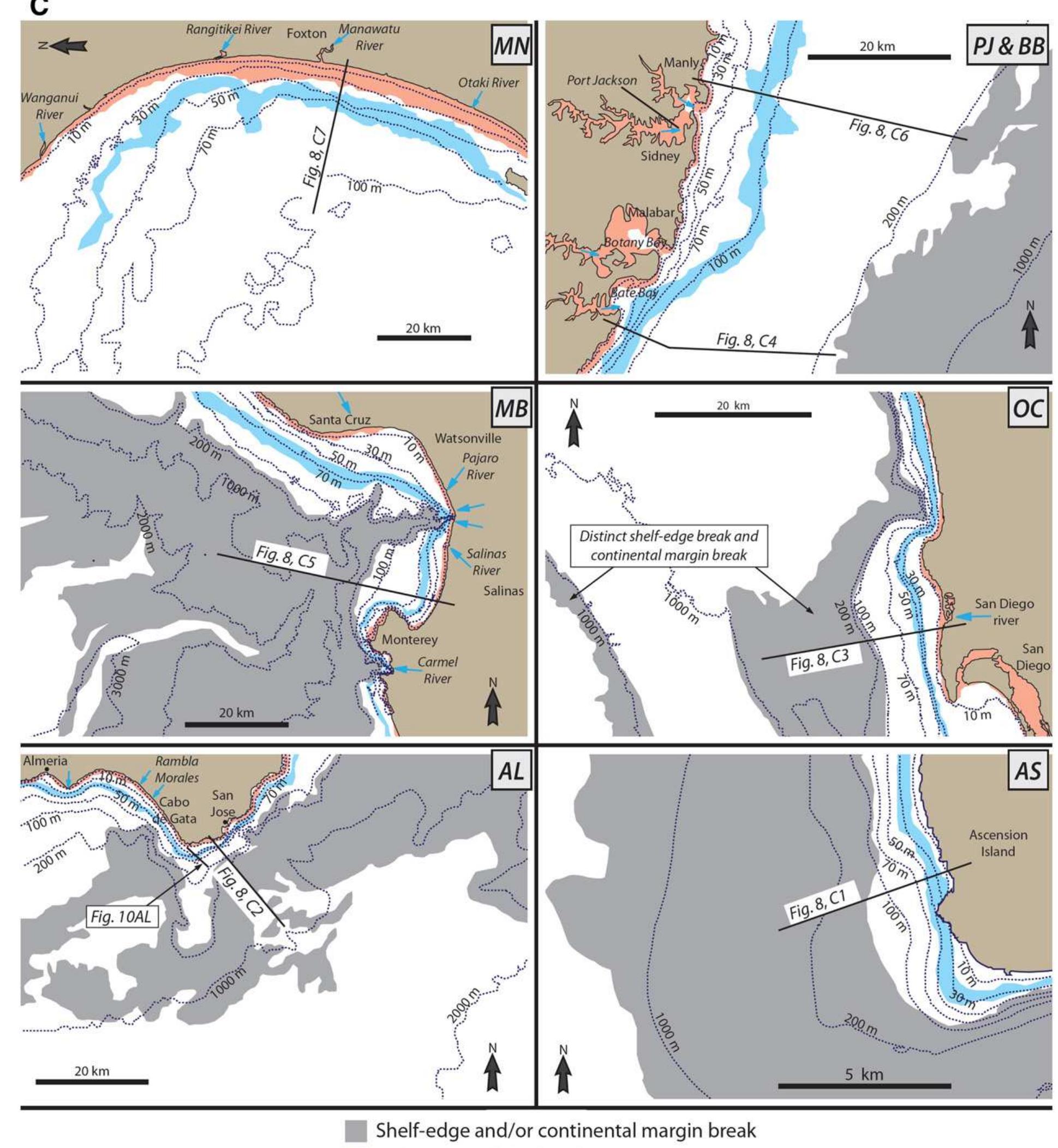
Figure 9 Rhone delta, a compound clinoform interpretation is also supported by Holocene sediment isopach and grain-size maps published by Gensous and Tesson (1997), Tesson et al. (2000) and Labaune et al. (2005). Australia coastlines; Field and Roy, 1984). In most examples, it is possi- ble to distinguish a subaerial delta clinoform at the shoreline, a subaque- ous delta clinoform in the middle of the shelf, and a clinoform marking the shelf edge (shelf-prism or continental-margin clinoform). In most of the examples presented here, maps of Late Holocene sediment thick- ness support the interpretation of actively accreting clinoforms situated at the three present-day breaks in bathymetric gradient (e.g., Nittrouer et al., 1986; Gensous and Tesson, 1997; Michels et al., 1998; Cattaneo et al., 2003, 2007; Liu et al., 2004, 2007; Lobo et al., 2005; Yang and Liu, 2007; Le Dantec et al., 2010). Below, we summarise four represen- tative and particularly well-documented examples of recent delta- Bathymetric contours and cross sections in Figs. 7-10 have been drawn using the Global Multi-Resolution Topography dataset of Ryan et al. (2009), and areas of relatively steep gradient on the inner-to- mid-shelf have been highlighted in the maps by grey shading. These steep areas form shoreline-parallel belts that generally correspond to the foresets of actively accreting clinoforms, although in some cases they may correspond to steep erosional surfaces (e.g., south-eastern